Iiníí

Early in November, 1887, John Nolan and other half breeds were near the forks of the Red Deer and South Saskatchewan when they came across a bunch of eleven buffalo, one of the bunch being a very large bull. They killed the big bull, two cows and a calf and brought them into Swift Current.  J. Grant got the head of the bull and Curry Bros.,  got the two cows heads and hide of the calf. No doubt afterword the half breeds cleaned out the rest of the bunch for they were never heard of again.

Hine of Winnipeg mounted the bull’s head and in 1893 it was loaned to the government and was sent to the World Fair at Chicago, where it was much admired…

The country lying between the South Saskatchewan and the Cypress Hills and Old Wives Creek and the lakes and the Vermillion Hills was famous for Buffalo and even now the old Buffalo trails and wallows are to be seen from Moose Jaw to Medicine Hat.

from a letter by “Wyoming Bill” to the Fort Macleod Gazette, 1902

Treaty Seven was signed in 1877. Barely ten years later, Canada’s last wild plains bison expired its last breath into the prairie sky. 

Canada’s first prime minister, John A. Macdonald, thought the eradication of North America’s largest land mammal was a very good thing.  “I am not at all sorry,” he said to Canada’s House of Commons in faraway Ottawa. “So long as there was a hope that bison would come into the country, there was no means of inducing the Indians to settle down on their reserves.”

The treaties at least assured the Indigenous tribes of the western plains that they would not starve. In exchange for that and other assurances, they settled on the reserves they had chosen and tried to come to terms with a world turned upside down. How could there be no buffalo? 

The Ghost Dance movement that originated with tribes who lived in the Great Basin region of the US spread through many of the plains nations. It was a spiritual practice whose adherents hoped would bring back the world they had always known, including the vanished bison. They were desperate in their loss; a world they had never imagined could end, had.

But the bison were gone for good. Settlers were coming to populate the empty plains. The newcomer people replaced the native bison with a newcomer animal: the domestic cow.

MacDonald’s government wanted to build a new nation from the Atlantic to the Pacific Ocean, and to secure its control over that nation before the Americans, who had a head start on settling the west, could appropriate the place for themselves. That was the basis of MacDonald’s National Policy.  His government’s problem, however, was that the land was vast and there were people living there already. The decision to negotiate treaties with those native peoples was, from the Dominion of Canada’s point of view, more a pragmatic than a principled one. They needed peace and order, so they had to negotiate.

As soon as the treaties were in place, the Canadian government started cutting other deals to secure its control over the land. First they arranged to build a railroad across the southern edge of the country. Until that was done there was no practical way to fill the place with farmers. So, as an interim measure, the government issued grazing leases of up to 100,000  acres to well-financed eastern Canadian and British investors.

That was another pragmatic decision. For one thing, it pre-empted any move by Americans to settle the lease lands. The new railway could ship beef as a source of revenue to start paying down its debt. And, perhaps most importantly: the government had promises to keep. It needed a supply of meat for thousands of Indigenous people now faced with the prospect of starvation.

The first huge grazing lease went to a well-connected Ontario conservative, Matthew Cochrane. He sold shares in his Cochrane Cattle Company to a few wealthy friends from Montreal and the Eastern Townships, imported some breeding stock from Europe, and arranged for two big shipments of mixed-breed cattle to be trailed north from Montana.  The new lease was centred on what is now the town of Cochrane; the home ranch was at the mouth of Bighill Creek.

Cochrane and his investor friends hired a well-respected mountie, James Walker, to run the ranch. Walker was a rigid, letter-of-the-law kind of guy, which had served him well as a policeman. When his bosses told him to do something, he did it. Unfortunately, that obsequiousness didn’t serve him well in his new job.

The investors had put a lot of their money into this new ranching enterprise, and they wanted to see profit sooner rather than later. They told Walker to get those American cattle onto that Canadian grass as quickly as possible. He followed their orders diligently, pushing a herd of 6800 tired cattle hard in order to get them to the Bow River grasslands before winter.  They arrived in bad shape just in time for one of the hardest winters on record.

Cattle aren’t bison.  When the north wind blows, bison turn their big, hairy heads into the wind and paw away the snow, grazing their way into the storm.  Cattle turn their backs to the wind and drift ahead of it. When snow covers the grass, from a domestic cow’s point of view the grass has gone. They don’t crater down to it like bison, elk or horses do.

Bison would have weathered the hard winter of 1881-1882 easily, but they were gone. The newly-imported cattle piled up against fences or in the deep drifted snow of coulees and river breaks. Most died.

The following year, again following orders from eastern bosses who had no idea of the West’s environmental realities, Walker drove another 4300 head of cows north from Montana during a dry, thirsty summer. The same disaster happened all over again that winter. 

Of the more than 11,000 domestic cows Walker brought north, by the spring of 1883 only 4,000 survived. Coyotes and eagles had a great spring; there was food galore. It was not a great spring for wealthy white men with high hopes for extracting big profits from the far frontier. They blamed Walker, even though he had simply followed their orders.

Only two decades earlier, there had been hundreds of thousands of bison here. They knew how to live there. So did the people who lived among them. But the future had arrived. Nothing about it was going to be easy, now that the place was full of strangers.

A century and a half later, the human population of Alberta has increased from less than 50,000 at the time of Treaty Seven to almost 5 million today. A gridwork of roads crisscrosses the plains and continues to metastasize into the boreal north. Towns have grown into cities and cities have grown into metropolises. It might seem like the buffalo days have been left forever in the past.

That would be a misconception. The buffalo have returned. Their reappearance in a land that had almost forgotten them might seem as impossible as their original disappearance was to the Niitsitapi who had lived with them so long. Even so, it is well underway.  Who knows what might happen next?

I met Wes Olsen in the early 1980s when I was assigned to a bird inventory project at Elk Island National Park, east of Edmonton.  I was still with the Canadian Wildlife Service, and Wes was a park warden responsible for the care of the park’s herds of pure-strain wood and plains bison. Tall, moustached and soft-spoken, Wes comes across more like a cowboy than an ecologist, but appearances can be deceiving: he is North America’s leading authority on the ecology and reintroduction of bison.

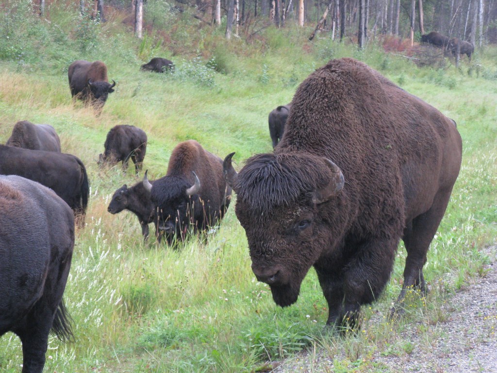
Wes was responsible for keeping Elk Island’s herds free of disease and for helping keep the population in balance with the available supply of forage. That meant that the herds had to be culled periodically. Rather than kill the surplus animals, though, Wes and his colleagues arranged for them to be transferred to new homes: bison ranches, small display herds in other prairie parks, First Nations reserves and even an ambitious project to restore some of the original Pleistocene megafauna to northern Russia. The Elk Island animals are considered the gold standard for bison recovery because they contain no domestic cattle genes and are kept free of the diseases that domestic cattle brought to North America.  Anthrax, brucellosis and tuberculosis have infected other conservation herds, including those in Wood Buffalo and Yellowstone National Park.

When Pierre Trudeau’s federal government established Grasslands National Park in the Frenchman’s River area of southern Saskatchewan in 1981, the park had no bison. Parks Canada imported plains bison from Elk Island in 2005 and, soon after, imported Wes Olsen too.  As the herd grew, Wes and his wife Johane Janelle studied the ways in which the big animals changed the prairie and its wildlife fauna. They soon realized that, just as the absence of bison had changed everything, their return also changed everything — for the better.

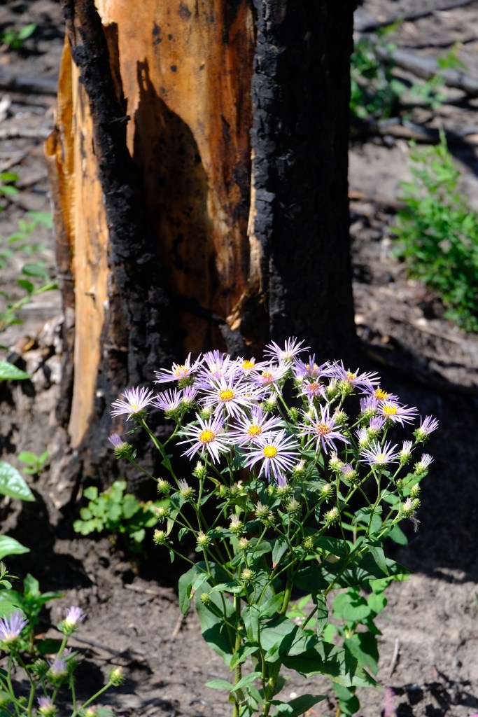
Bison wallows create small hollows that fill with meltwater each spring and create breeding habitat for frogs and insects. Bison shed their wooly underfur each spring; songbirds use the wool to line their nests. Bison wool not only provides superior insulation for eggs, it also disguises the odour of the nestlings, increasing both hatching rates and nestling survival. Literally hundreds of species of insect and other arthropods are attracted to bison droppings. Some of those insects burrow into the ground, increasing the soil’s porosity and enabling rain to soak in more thoroughly. Others are vital food sources for horned lizards, loggerhead shrikes, sage grouse and other species that were once abundant but are now endangered. In winter, pronghorns, deer and grouse feed in the snow craters that grazing bison carve out of the snowpack.

Wes describes the plains bison as a keystone species — a species whose presence or absence has much more far-reaching effects on their ecosystem than other animals. Beavers are another keystone species. So are we.

In 2022 Wes and Johane released The Ecological Buffalo, unquestionably one of the best books of applied ecology ever published in Canada.  It details the many threads of connection linking plains bison and the rest of the prairie ecosystem. The sheer complexity of the relationships Wes and Johane describe is a sobering revelation of what was lost when that last prairie bison fell to a hunter’s bullet a century and a half earlier. But it is also an awe-inspiring revelation of what prairie Canada might again be, if the bison were to return.

And it’s not a question of if, any more. It’s happening. 

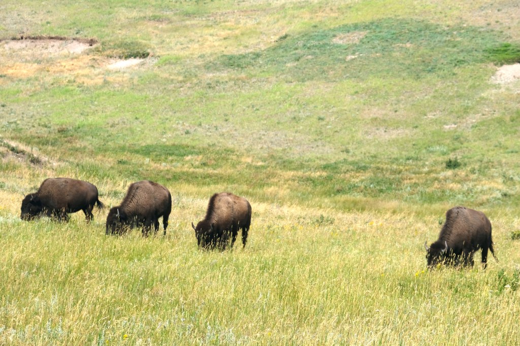
In 2005, bison returned to Grasslands National Park. From an initial release of 71 young animals from Elk Island, the herd has grown to more than 500. Their trails, wallows, dung and grazing patches again shape that relict prairie ecosystem. They graze among prairie dogs and long-billed curlews. Their odour mingles with that of sage and wild rose. The place is real again.

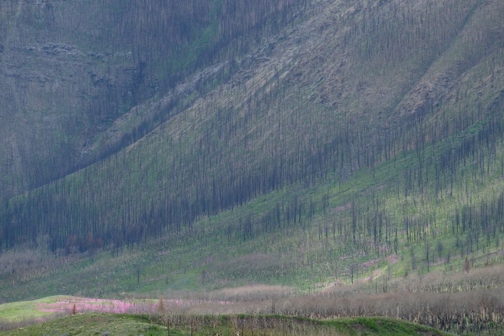
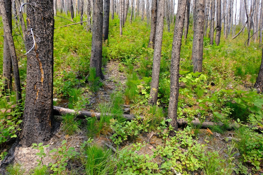
Thirteen years later, another 16 plains bison went from Elk Island to a new home in the wilderness of northern Banff National Park. That herd, which regularly encounters grizzly bears and wolves, has since grown to more than 100. They range widely from alpine meadows through burned-off mountain slopes to the fen meadows along the headwaters of the Panther, Dormer and Red Deer Rivers. The herd may soon outgrow the available range. The need to trim the herd has led to another restoration — that of the age-old hunting traditions of the Iyarhe Nakoda and Siksikaitsitapi.  The return of bison to Canada’s first national park — a park whose origin story includes the ejection of those Indigenous people whose homeland it had always been — may help heal more than just the land.

“What would happen if you took the cross away from Christianity?” Kainai elder and teacher Dr. Leroy Little Bear said when I interviewed him in 2017. “The buffalo was one of those things.  The belief system, the songs, the stories, the ceremonies are still there, but that buffalo is not seen on a daily basis…The younger generation do not see that buffalo out there, so it’s out of sight, out of mind.”

Little Bear played a pivotal role in drafting the Northern Plains Buffalo Treaty, the first Treaty among Indigenous nations in over 150 years. Initial signatories in the fall of 2014 included the Siksika, Piikanii, Kainai and Tsuu T’ina First Nations as well as Assiniboine, Gros Ventre, Sioux, Salish and Kootenai tribes from south of the 49th parallel.  The Stoney Nakoda First Nations signed on a few months later. Other First Nation groups continue to join the treaty each year.

“The Buffalo Treaty is very historic,” says Little Bear. “A treaty among just Indigenous cultures to work together on common issues: conservation, culture, education, environment issues, economics and health research. In the centre of that is the buffalo.”

“Our elders said, we want to restore the buffalo. But it’s a big job. We can’t do it on our own. We need partners.”

Marie-Eve Marchand, a passionate conservationist of Quebec settler stock, is one of those partners.  She was a founding member of Bison Belong, an advocacy network formed in 2008 to pressure Parks Canada to follow through on its commitment to bring bison back to Banff National Park and to build social license for the initiative.  That work successfully completed, Marchand moved on to provide administrative support and media coordination for the Buffalo Treaty. She worked with both Niitsitapi and their allies from among the newcomer peoples on the Iiníí Initiative, which was meant to rematriate bison in Niitsítpiis-stahkoii — Blackfoot territory. 

“We eliminated the beaver and the bison, both keystone species,” she says. “Now we are turning that around.”

“With the return of the buffalo,” Dr. Little Bear adds, “those things that were part of those regularly occurring patterns in nature, the buffalo was part of it. So we’re bringing back those regularities and those regularities are part of what anchor our societies.”

“But there’s a whole lot more. There’s also their larger role in the ecosystem.  As a human species, we play a very small role in that ecosystem. And it’s a big job to bring about an eco-balance. So we need help and the buffalo will do that.”

Two years after the initial signing of the Buffalo Treaty, the homecoming of Iiníí became more tangible, with the arrival of 88 plains bison in northern Montana from Elk Island National Park. Their new home was a tribal ranch on the Blackfeet Reservation. They were home, but still behind fences. Then, in 2023, the Blackfeet released 25 bison into their ancestral range on the foothills slopes below Ninaistako. Wild bison were back in the Crown of the Continent.

Tristan Scott of the Flathead Beacon was present to report on the homecoming. Tribal elder Ervin Carlson told him, “To see them out here, it just choked me up. It’s a real good feeling. It finally feels right, after feeling wrong for a long time.”

It finally felt right. But for most of the twentieth century, it was unimaginable. Our only bison story was one of loss. What else might we imagine? We live in a landscape our choices shape, and in a landscape of possibilities our stories create. We have a new story now, a better one. Those landscapes are changing for the better.

If the bison can come home, perhaps we can too. All of us, together, as the Treaty People we are meant to be.

Disaster

[an invisible friend, one of many on Facebook, edits an online magazine called Hubris. An American, she sent out a plea for essays that might help her, and many others who think and feel in the same way, come to terms with the outcome of their recent election. So I tried (apologies for the Imperial measurements; I wrote it for an American publication):]

There is a pinch point in the Rocky Mountains chain that geologists call the Lewis Overthrust.  It extends across the US-Canada border and includes two of our oldest mountain national parks: Waterton Lakes, in Canada, and Glacier, in the USA. The subterranean paroxysms that gave rise to those western mountains were so powerful here that they pushed slabs of mountain rock over top of each other, like overlapping dominos, until that shifting rock had buried whole ranges of mountains and foothills.  Drive up to the Lewis Overthrust from the east and the effect can be startling: the prairie ends and the mountains are there.  No transition.

That orthographic pinch point lies east of a flattening in the landscape: the Columbia plateau. Those two geologies combine to create the perfect storms.  Storm after storm; westerly winds sweep inland from the Pacific Ocean and, finding little resistance through the Columbia plateau, pile up against that skinny bit of mountains before spilling over the top and sweeping down to the prairies.  It’s a continental-scale Bernoulli effects that yields relentless winds on the eastern side of the mountains, with gusts that regularly exceed 80 mph.  Anywhere else, that would be called hurricane-force.  In the lee of the Lewis Overthrust it’s called the chinook wind.  When we lived in Waterton, it sometimes blew our children down the street.  Fortunately, it blew them to school. Getting home could be a bit of a problem.  They wore ski goggles in winter, and sometimes crawled.

On August 29, 2017, during an intense summer thunderstorm, lightning struck a tree in southwestern British Columbia, about five miles west of the Continental Divide, on Kenow Mountain.  The tree burst into flame, and the fire spread. The forest had been primed by drought and heat… and after the storm blew through, a chinook wind developed.  By September 11 when gusts of over 90 mph drove the fire across the Continental Divide, fire crews didn’t stand a chance.  They had set irrigation sprinklers up to protect the park townsite, but when that roaring inferno arrived all they could do was to get out of the way and watch the fire storm burn through.  The town was saved, but almost half of the 195 sq.mile park burned.  And it wasn’t just the trees and grassland that burned; the fire was so intense that it burned the very soil, right down to the rocks and gravel.   It was an utter disaster.  It could have been worse, but the turbulent wind created back eddies that stalled the advance of the fire until a change in the weather settled it down and enabled the fire crews to get back in and start mopping it up.  Everywhere there were dead and wounded animals. The place ached with loss; all its life and stories and meaning seemed gone with the smoke.  News stories reported that the park was destroyed

I visited the national park three weeks later.  It was burned to the very mountain tops, a bleak place of blackened tree trunks, grey ash and silence.  And in the charred prairie along the park road: brilliant green spikes of emerging grass. They didn’t look defiant, but they looked determined.  They knew the place was meant to be alive. Theirs was a wisdom deeper than ours.

In the ensuing decade, it has indeed come alive.  Many of the burned trees have fallen but as many more still stand, their boles now riddled with holes drilled by woodpeckers that have been attracted by all the wood-boring insects thriving in their new homes, homes created by flame. Absent the stifling shade of closed coniferous forest canopies, the understory has erupted in greenery.  When I worked in Waterton in the 1990s, I knew of three small patches of wild hollyhock; now those green pillars of floral beauty seem to be everywhere.  In summer, the flower mosaic has to be seen to be believed. Bighorn sheep feed on green slopes where encroaching forest had previously been shrinking their ranges.  Eagles still wheel above the summits; the bull trout still return to spawn. It isn’t the glorious place it was.  But it’s becoming the glorious place it’s now meant to be.  It wasn’t a disaster; it was a turn of the circle.

Immediately after the fire, teams of archaeologists descended on the park. The archaeologists, including two young Siksikaitsitapi (Blackfoot) researchers, saw the fire’s aftermath as a once-in-a-lifetime opportunity to find evidence of previous human occupation. With the vegetation and duff burned away, old campsites, structures and artifacts lay exposed in the ashes. Crews hastened to inventory the park’s archaeology before it could be obscured again by vegetation. They found camps and remains everywhere — a startling record of more than 12,000 years of continuous occupation by Niitsitapi. The archaeologists had to revise their story; this was not a place the Blackfeet visited occasionally or travelled through to trade or hunt; it was a centre of their existence. The Siksikaitsitapi are not just a prairie people — they are mountain people. But that had almost been forgotten.

The researchers decided to examine the mountaintops. They found seventeen different vision quest sites.

Dr. Mike Bruised Head, a Kainai researcher, described in his Ph.D. dissertation* how deeply troubled he felt. These Itaksiistsimoo’pi were meant to be places of fasting and visions. But almost nobody visited them anymore. There was little point. The mountains no longer had their original Indigenous names. A vision quest begins with an invocation of the mountain’s spirits, and that requires that the seeker pray to the mountain by its name. The names seemed to have vanished, to be replaced with names that had no relevance — like Mount Vimy, named after a battlefield in faraway France. In consultation with elders and other knowledge-keepers, Mike Bruised Head determined that its true name is Sakiimaapi.  One by one, he has been working to find the original names of those sacred mountains and restore Niitsitapi relationships with the place.  The park’s new interpretation centre uses those original names, and the interpretive signs sprouting up across the recovering landscape tell the deeper story of meaning that has emerged from those ashes.

This year, Parks Canada and the Blackfoot Confederacy announced a new Indigenous Guardians program that employs Siksikaitsitapi people to monitor and protect these sacred lands.  In doing so, the guardians will rediscover themselves, while offering new relationships and learnings to park visitors many of whom are, themselves, in search of deeper meaning and connection.

Barely a decade after disaster, the park is experiencing both an ecological rebirth and a renewal of its names, meanings and cultural relevance. It isn’t the place it was. It’s becoming something better.

When disaster strikes, it’s all we see. The despair and horror come from seeing the end of what we knew and loved, and the certain knowledge that there can be no going back. What is unknowable, in that awful moment, is what might come next; what possibilities await beneath the ashes.  But they are there, and after the flames burn down and the last wisps of smoke dissipate into the winds, the world will still be with us and it will have lost none of its magic. None. Some of its magic, in fact, will have been set free.

One of the most common trees in that wind-whipped landscape along the Lewis Overthrust is the lodgepole pine.  It forms dense stands that, as they mature, grow a dense, connected canopy that shades the ground below.  By the time a lodgepole pine forest has grown old, its thirsty roots and crowded canopy have suppressed or killed many of the other plants that were there when the trees were young and small.  And that’s okay; snowshoe hares, squirrels and crossbills like those dense old forests.  But there is a sense of suppressed sameness to a landscape dominated by those pines.

Fortunately, they burn.  The older and denser they are, the better they burn.  That’s one reason the Kenow fire was so intense; not only was it wind-driven but it was fueled by aging pine forests full of tree resin and crowded fuels.  Those trees are dead now, and the other kinds of plants whose growth they once suppressed will have their time in the sun again for a few decades.

But lodgepole pine is a paradox: it exists to be killed by fire, yet it relies on fire for its very existence.  Its cones are like rocks, sealed tight by resin, their seeds securely stored inside.  Fire burns off the resin coating and twists the cone scales open, releasing the seeds.  The dead lodgepole pine forests of Waterton Lakes National Parks, today, are full of live lodgepole pines: young ones, reaching their baby fingers joyfully into the sun beneath mountains that are rediscovering their ancient names, amid a coming together of Treaty People — both the Niitsitapi who were always here and the more recently arrived who hike the trails as tourists. The aftermath of disaster offers new hope of deep, real sorts of reconciliation.  Not just between peoples, but between people and place.

And this is what was unimaginable in the moment when the flames came.

There are other kinds of disasters. Sometimes an election’s outcome can feel like a disaster.

When those disasters beset us, it can be worth reflecting on the Kenow fire and the certain truth that magic sometimes is just waiting for its moment, even if we can’t see to the other side of the flame and smoke. Things that happen are never just events; they are teachings that are given to us by the living world that gives us all our life and all our meaning. Fires burn out; new things emerge. Sometimes better things. This is a truth given to us.

I’m trying to learn to think like a forest — to listen to the teachings of the world.  It is always the end of things; it is always the beginning of things.  The names of our mountains outlive the battlefields after which some might try to name them.

It will be okay.  It might, eventually, even be better.

* reference: Ninna Piiksii, Mike Bruised Head. 2022. The Colonial Impact of the Erasure of Blackfoot Miistakistsi place names in Paahtomahksikimi, Waterton Lakes National Park. Ph.D Thesis, Dept. of History, University of Lethbridge.

A Wild Sign of Hope

Lorne Fitch, P. Biol.

It’s an increasingly busy world, with more development, acres of pavement and noisier. Looking at our human footprint and the crush of people, all wanting more space, more resources, more of everything except wild country, wildlife and peace and quiet, it’s easy to fall into despair.

The northeast quarter of section 36 is our refuge, but it’s tiny in comparison to the developed world and what is required to maintain biodiversity and the other essential ecological services. It is a pretty quiet place though and so the rattling bugle call of a sandhill crane was unmistakable. One floated into the wetland on set wings, with a clear destination in mind.

We don’t know how old the wetland is. It probably began as a beaver dam and spread into a basin that collected and held water. Around the edges willows sprouted and in the interior cattails proliferated. All of this took time, maybe time beyond our imagining. 

Every spring though, the chorus frogs wake up the wetland, and us. There probably was a time when the wetland was also awakened with the rattle of crane music. But in the previous three decades of our ownership no cranes graced the wetland, except maybe for a temporary look.

The historical breeding range of cranes was the Prairie Pothole Region, but up to 40 per cent of the wetlands there have been drained. Worse yet, wetland loss exceeds 90 per cent in parts of the region. 

Early hunting and later habitat loss caused large declines in the population but crane numbers in Alberta seem to be steadily increasing with “excellent survival rates for adult and young birds,” according to biologists with the province. In the southwestern foothills this seems evident and might reflect some population migration north from similar habitats in the western US.

Nonetheless the birds are still considered Sensitive in Alberta, a reflection of habitat vulnerability that still defines population persistence. In spite of the designation Alberta opened up a hunt for sandhill cranes in 2020. My late colleague and friend Hugh Wollis raged against the hunt and asked penetrating, impertinent questions of federal and provincial bureaucrats over the dubious biological rationale and lack of supporting evidence.

Unkind thoughts of a mercenary government minister lobbying for a hunt with suspect motives were pushed to the side as I picked out not one but two birds through my binoculars. The standing bird was tall, towering over the wetland grasses, a gray body with brownish tones and a deep red “cap.” From the stance of the bird I could see why Aldo Leopold would write of cranes, “nobility, won in the march of aeons.”

Almost hidden by grass and cattails was the other bird, clearly sitting on a nest. To suggest this was a thrilling sight is the mildest of understatement! Seeing nesting cranes on the wetland created a feeling beyond the reach of words.

These cranes make the wetland and the NE of 36 more complex, more compelling and more complete. There is hope that eggs will hatch and the colts survive. In doing so, adult cranes might sense a place to return to, time and time again. In their annual return (fingers crossed) will be the endless ticking of an ecological clock. 

A spring return will confer a particular distinction on the wetland, of a secure and safe place to nest. A crane wetland holds a patent of nobility, rising above the commonplace, providing a sense of timelessness. Wetlands provide wildness and as Leopold pointed out, “the crane is wildness incarnate.”

Maybe we might yet see the elaborate mating dance, the stretching of wings, pumping of heads, bowing and leaping into the air in a graceful and energetic pageant. And, to hear that iconic call, a signal of the wild and all the wild implies.

Leopold’s prophetic words on cranes registered: “When we hear his call we hear no mere bird. He is the symbol of our untameable past, of that incredible sweep of millennia which underlies and conditions the daily affairs of birds and men.”

The landscape of the NE of 36 seems timeless but of course it isn’t. It lies in and is influenced by a changing world, one of more cultivation, more land clearing, more wetland drainage as well as drought exacerbated by climate change. But for the moment we will cheer on the ray (and call) of hope brought by a pair of nesting sandhill cranes.

June 2024

Lorne Fitch is a Professional Biologist, a retired Fish and Wildlife Biologist and a past Adjunct Professor with the University of Calgary.

Requiem for a River—The Tortured Life of Alberta’s McLeod River

Lorne Fitch, P. Biol.

One wonders if a river sometimes curses its geological underpinnings. When other rivers were given diverse attributes, the McLeod River was given coal, underlying most of its headwaters.

If the coal had been left in place, buried, the McLeod would not have suffered so many indignities. But from the early 1900s up to the present day, we have dug and tunneled under and blasted the tops off mountains to wrest coal from its origins. The mayhem left behind after more than a century of coal mining influences the watershed and especially the watery inhabitants.

One could blame the Canadian Geological Survey and D. B. Dowling, a noted member of it for writing in 1908,  “Higher grade steam and coking coal may be obtained from more distant fields, to which approach is more difficult, since they are situated behind high, rocky ridges. On the McLeod the upper part of the coal-bearing horizon was observed to have about 20 feet of coal seams.” 

This piqued the interest of many who saw potential for a source of “steam” coal to fuel steam locomotives. But the area needed a railway to open up this inaccessible area, soon to be known as the Coal Branch. A branch line of the Grand Trunk Pacific Railway was constructed in 1911, south from Edson to Coalspur, where mining began in 1912, and on to Mountain Park.

A booming market for coal eventually brought 26 companies, operating on 80 coal leases. This translated, from 1912 to 1960, to at least 22 underground mines and 11 surface, strip mines. Mining, of one form or another proceeded in all of the McLeod River headwaters at Cadomin, Sterco, Mercoal, Luscar and Mountain Park. Most crashed in the late 1950s when railways switched to diesel locomotives.

Mining resumed in 1969 at the old Luscar site. Others followed including Gregg River, Cheviot, Coal Valley, McLeod River and McPherson (Vista) strip mines. Compared to earlier mines, the footprint of these mines are immense. After mining life spans of two to three decades, the Luscar, Cheviot and Gregg River mines are being “reclaimed” while the others remain somewhat operational, retired or suspended. As the future of coal dims, in a world beset by greenhouse gas emissions from the burning of fossil fuels, these mines are sowing the seeds of their decline.

The headwaters of the McLeod River and its upper tributaries the Gregg and Embarras rivers hosted mines (underground and surface), railways and company towns. Each mine had a loading tipple, sorting facilities, power houses and railway tracks all squeezed into narrow valley bottoms.

 Archival photos show burned forests, probably sparked from locomotives, and ones stripped of trees for mine props and other mine infrastructure. Old photographs of floods and landslides are commonplace, likely due to forest removal for mining. 

Piles of waste coal and the occasional concrete pillar from these underground mines provide some of the only landmarks of past endeavours. All are situated in tight valleys, on the edge of rivers and streams. None of the sites were ever reclaimed, in any sense of the term. 

Every rainstorm, every snowmelt allows a bit more sediment to bleed into the water, filling in the nooks and crannies of the substrate where aquatic insects live and where trout find refuge. Some sites have been doing that for over a hundred years, an unfortunate legacy. Some may continue to contribute coal fines for another century or so.

Mine adits, the entrances to dozens of underground mines, locations now largely forgotten, probably still leak water of dubious and unknown quality from a labyrinth of flooded mine shafts.

Coal mines, the surface strip variety, were located (and continue to be sited) in steep terrain where gravity endlessly exerts force. The procedure was (and is) brutal where heavy machinery (coupled with explosives) totally removed soil and rock overburden and then the coal beneath. 

This has transformed steep landscapes from being unique, sensitive and relatively stable ecosystems to ones blasted, shattered, excavated, cut and dumped into unstable piles of rock, dirt and dust. The areas are highly vulnerable to erosion, at the mercy of rain, snow and wind, both during the mining phase and well beyond. 

All of these mines have had some sort of acute or chronic operational or engineering failure of settling ponds, roads, conveyance systems or mine surfaces often resulting in catastrophic spills of coal, sediment, tailings or something else into receiving streams. 

Dozens of streams have disappeared into the maw of coal mines—named, unnamed, intermittent and temporary ones—never to reappear. The latter two systems, often dry at least on the surface, conveyed subterranean water, bolstering flows in larger, named streams. They’ve been ignored and underrated. 

Perhaps hundreds of kilometres of streams have been permanently buried,  dislocated, truncated and diverted, reflects Carl Hunt, a retired regional fisheries biologist. Little attention has been paid to these little streams and their contribution to larger aquatic ecosystems.  

Mining companies provide photos of reclaimed surface mines as green meadows amid rolling hills, with just a few, elongated blue ponds with bare headwalls. These are sylvan scenes taken at very desirable locations to extol the ability to reclaim former holes in the ground. 

What is rarely shown is the overall scene of utter devastation created by a surface coal strip mine. And, what is unseen, unappreciated and mostly unmanaged are the elements leaching out of the overburden, blasted and shattered and dumped to expose the coal seam. 

Sediment, nitrates, metals and other ions are liberated during mining.  Selenium, antimony, cobalt, lithium, manganese, molybdenum, nickel, strontium, thallium, uranium and many others are released for decades by the weathering of the shattered caprock overburden. This produces a veritable witches’ brew of toxic chemicals, either individually or in synergistic combination.

On the bright blue, sunshiny days when the photographs are taken of the efforts to make a black mine site green, it’s hard to see the effects of rainfall and snowmelt on a landscape that has lost its ability to trap, store and slowly release water. Compacted mine spoil coupled with the loss of intact forest speeds up runoff and erosion. The water is gone in a flash, leaving nothing for the rest of the year. Downstream fish wonder at the sudden influx of muddy water, followed by a dribble, or dust.

These high elevation areas are difficult, if not impossible (in any sense of relative time) to vegetate and reclaim to any degree of a pre-existing condition. Even the coal companies recognize the hurdles of reclamation with: “Elevations range from 1,400 to 2,000 metres and soils are generally thin and rocky. The climate is severely influenced by the mountains and the elevation; snow is common in all months of the year. Strong Chinook winds blow in the winter, melting and moving snow and creating a very difficult growing environment for plants and young seedlings.”

While it can be argued that “wildlife diversity is maintained by an ecosystem approach to reclamation that restores pre-mine habitat condition, replaces habitat function, and exchanges certain components for others of similar benefit,” this is not the case with native fish mitigation. The best they have been able to do is repurpose unclaimed mine pits into trout ponds.

The value of these pits for fisheries mitigation is questionable and probably useless. No spawning areas are available, requiring regular stocking to support a fishery.  Native trout populations and their habitats are not replaced in any equitable way. Plus, natural, unimpacted streams were found to be 10 times more productive for trout than mine pit lakes. Research also has shown selenium bioaccumulation in trout which poses a risk to human health through consumption of these fish.

Fish are the ultimate arbiters of the effects of land use, since everything that happens in a watershed inevitably flows by and sometimes through a fish. Arguably the McLeod watershed is the epicentre for the Athabasca rainbow trout, Alberta’s only native rainbow trout (the others are transplants from elsewhere). 

When R. B. Miller, Alberta’s first fisheries biologist, surveyed the watershed in 1948 he commented that, “Rainbow trout are present in incredible numbers in every little creek and beaver-dam, in the larger tributaries and in the main McLeod.” He also found bull trout and Arctic grayling throughout the streams.

Now Athabasca rainbow trout are designated as Endangered throughout the Athabasca watershed, including the McLeod. A perfect storm of land use, including coal mining, has led from “incredible numbers” to nearly gone. There has been a 92 per cent reduction in fish biomass downstream of coal mines in the upper McLeod watershed.

One can blame the lack of any early environmental laws, the exuberance to extract wealth from the watershed and the enduring impacts of cumulative effects. Part of the demise of the Athabasca rainbow trout populations was the antipathy shown them by anglers and even biologists like R. B. Miller. Miller derisively commented that, “The low temperature and poor food supply have converted these Rainbow trout into a dwarf race of absolutely no sporting value…”

For populations of these feisty little trout, passing the evolutionary test of surviving and thriving in a rigorous and challenging environment wasn’t enough. They also had to be big enough to catch. These trout are not dwarves, or stunted, but grow to the full potential of cold, unproductive waters, in a short season.

It’s the unseen legacy of coal mining, especially selenium, that will plague these little trout and their relatives the bull trout and Arctic grayling into the future, worries Connie Simmons, former member of the Athabasca Bioregional Society. Selenium is an element vital in small amounts but toxic in excess. It doesn’t take much to damage the liver, kidneys and heart of fish. It can reduce the number of viable eggs a fish can produce and lead to deformed spine, head, mouth and fins. It bioaccumulates in aquatic insects, essential fish food.

An Alberta government document states: “Current assessments indicate there is no risk to humans who drink water or eat fish containing excessive amounts of selenium.” But, this source has long been recognized for its muted, industry-friendly response to environmental issues.

Bill Donahue, a noted environmental scientist and colleague of David Schindler, looked at mining related selenium contamination of McLeod waters from 1990 through 2016.  He found that selenium levels averaged almost six times higher in the McLeod River downstream from the Cheviot mine. They were nearly nine times higher in the Gregg River and 11 times higher in Luscar Creek, despite years of reclamation. Selenium levels in all the samples from the Gregg River and Luscar Creek exceeded those considered safe for aquatic life. Levels were nearly four times higher in the Gregg River and nearly nine times in Luscar Creek. The level was exceeded in about one-quarter of the McLeod River samples.

The verdict is still out on the downstream effects and legacy of mining well beyond the headwaters and into the Athabasca River. There is a maddening unwillingness in each new mine proposal not to look past the mailbox of their own endeavour to the wider watershed. Each proceeds based on an assumption no other mines exist and theirs is but a minor inconvenience to fish, wildlife, water quality and scenic aspects.

Mine proponents and their apologists (including those from logging and petroleum interests) say the problem with environmental interests is they keep interfering with the legitimate, wealth-generating blessings of a conflicted government operating with a free market ideology. This hampers economic genius through unnecessary rules and regulations, with onerous monitoring, mitigation and occasional legal charges. Maybe that’s so, but the McLeod has borne too much.

The trout and the river know the truth about coal mining and it isn’t pretty.

June 2024

Lorne Fitch is a Professional Biologist, a retired Fish and Wildlife Biologist and a past Adjunct Professor with the University of Calgary.

What Happens When a Tree Falls in a Stream?


A bull trout redd beneath a jumble of large woody debris, headwaters tributary of Oldman River

Lorne Fitch, P. Biol.

Some years ago I attended an American Fisheries Society conference. It was three days of dense descriptions of fisheries research. At the finish I was numb at both ends. It ended, as most do, with a banquet and an after dinner speaker. Did I mention alcohol?

After we were stuffed and somewhat medicated the speaker invited us to close our eyes. I thought, “This is my fondest wish.” We were asked to imagine ourselves under sail in 1778 off the coast of Hawaii.  It felt strangely comforting to do so.

“Imagine,” the speaker said, that a shout comes down from the crow’s nest, “I can see the tops of trees.” Then, “I can see big canoes, with outriggers, made from big trees, being paddled out to us.” His voice then rose in volume, shocking us out of our somnambulant state. “Where did the trees come from?” he asked.

Our reverie was over, it was time to reengage our brains. The speaker was James Furnish, then the Deputy Chief of the US Forest Service. He pointed out the logs used to build those dugout canoes were from rivers of the Pacific Northwest, like the Columbia. In flood time they had been washed out of rivers and had floated across the ocean to the Hawaiian islands. In the present age this is unlikely to occur because logging, dams, agriculture and urban development has dried up the supply of logs.

Furnish, once he had our attention, went on to give us an engaging, entertaining talk on large woody debris and its function in stream dynamics and fish habitat. It opened my eyes. With that new knowledge I started to look at wood with new eyes, appreciative ones. An observation of the Oldman reservoir one day, as the dam operator was dragging logs out of the entrance to the spillway, started me thinking. 

At that time we were doing regular flights of the Oldman River, downstream of the dam, to inventory angler numbers. To the angler count was added the number of large logs that could be seen from the air. What became clear was that large logs were mostly missing from the river as far downstream as Ft. Macleod. 

Since part of the fisheries mitigation program for the Oldman reservoir had a downstream component, I pointed out that lack of instream wood would seriously impact improvement of fish habitat. That’s when I was told the budget for fisheries mitigation had been spent and once spent, mitigation had been achieved. Instead of taking logs out of the reservoir and refloating them downstream, they were burnt.

At about the same time the Habitat Branch of Fish and Wildlife was either directing mitigation to repair things like pipeline crossings or attempting to improve fish habitat conditions on small streams. What worked and tended to linger were log walls to slow bank erosion, logs pinned perpendicular to the channel to form plunge pools and root wads building log jams.

Dr. Kim Green reaffirmed, with elegantly simple explanations for the intimate connection between forests and fish, the role of large woody debris. This knowledge on the complex nature of rivers comes from her own research in Columbia River watersheds and from the substantial research undertaken in  Pacific Northwest systems. 

If a trout population is to persist, it must replace itself. All trout species require gravel of an optimal size in which the females excavate depressions, called redds, where eggs are deposited. These gravels are constantly on the move during high water, driven by greater water velocities. Logs, especially those that array themselves perpendicular to the flow, slow water and trap gravels.

Logs of all sorts and sizes add to channel roughness, decreasing water velocity and creating areas of slower moving water, including pools, where fish can rest. The differences in water velocities between a channel with wood and one without can be measured in orders of magnitude. Slowing water down, with obstructions, forces an exchange between surface and subsurface flows. Water directed downward into the substrate is stored longer, emerges cooler in the summer and warmer in the winter, delighting trout.

Often the overhead cover created by a log jam or a tree that wedges itself along a streambank provides trout escape from predation and predators such as anglers, whose lures and flies adorn the logs. That same woody material also armours a bank from erosion, decreasing the addition of sediment. It also creates shade, reducing the sun’s influence on water temperatures.

Streams and rivers of the Eastern Slopes are relatively infertile. Wood, bark, needles and leaves are the essential building blocks of stream productivity. Trout don’t eat wood directly but, like us requiring an intermediary like an herbivore, benefit from those critters that do process wood, such as aquatic invertebrates.

When a tree falls in a stream the dynamics and complexity of the system are enhanced. Benefits to fish ramp up considerably. What happens when trees don’t  fall into a stream? The distribution and abundance of trout decline and they may disappear. This is particularly troublesome if those trout are native species and are categorized as species at risk, which almost all are.

I’ve spent many hours in helicopters flying watersheds of the Eastern Slopes. From the air one of the things that jumps out is fallen trees and log jams in stream and river channels, or on the floodplains. Occasionally, in isolated reaches, it looks as if a lumber yard has been parachuted into the stream valley. But mostly, there is little wood observed in these stream channels. 

Jim Rennie, an avid angler, observes there are many reaches of southern Alberta waters that lack “holding” habitat, without the structure and complexity to attract and hold trout. This was confirmed in a research study of the upper Oldman watershed, using aerial photographs from 1983 as the base. There was an overall reduction in large woody debris volume and orientation, as well a significant decrease in functional wood in reaches of North Racehorse Creek, the upper Livingstone River and the upper Oldman River. All these watersheds have an extensive logging footprint.

Why aren’t trees falling into the streams and rivers of the Eastern Slopes? Again, Dr. Green’s observations from several studies in the Eastern Slopes are illuminating. Basically she points out that, “there has been an increase in the frequency of flood disturbance related to logging.” Climate change is a driver, but the footprint of logging may exacerbate snowmelt and rainfall events. Flooding is now more frequent plus the floods are of a greater magnitude and severity (several 100-year floods in less that 20 years).

Ironically, flooding is key to the recruitment of trees to stream channels. Flood flows pick up downed trees and topple others from the floodplain, depositing them into the channel. Narrow or no buffer zones from logging means there is less wood available to be added to the channels. More and bigger floods flush wood out of headwater streams and rivers.

 Dr. Green has described one big flood in the Oldman watershed (1995), exacerbated by the logging footprint, that lofted much woody material far up on the floodplain where it remains inaccessible from floods of lesser size. There it sits, rotting away, instead of residing in the channel where it can persist for a century or longer.

Wood in streams is on a conveyer belt, from the slopes to the floodplain, to the channel and on downstream. Some of it hangs on through floods, relatively permanent, but much slowly migrates downstream. For the stream system to retain its dynamics and complexity, wood needs to be constantly added. If, at any time, that pathway of wood is interrupted, the stream can down cut during a flood, incising its channel deeper into the floodplain. Then, wood may not intersect with the water.

With about a century of logging behind us and fifty years of them as intensive, industrial-strength, clear-cut logging I’m not sure we have many, or any unimpacted watersheds left in the Forest Reserves that can form an image and a benchmark of what they were like before intensive logging.

My colleague, Dr. Michael Sullivan, describes some isolated rivers in the National Parks with amounts of large woody debris resembling the jumbled game of Pick-up sticks. Bull trout, in trouble beyond the park border, are plentiful and big in these wild watersheds. This reminds me of Aldo Leopold reflecting on a journey in a pristine place: “It is here I first realized…that all my life I had seen only sick land…here was a biota still in perfect aboriginal health.”

For recovery of native trout we must first acknowledge something has gone missing from their waters. Wood, in its various forms and sizes has in many watersheds. There are four pillars of trout habitat—clean water, cold water, complex habitat and connected habitats. Wood adds to, perhaps is essential for habitat complexity. Wood scarcity is like musical chairs, the children’s game of elimination where there are less chairs than kids. It’s no different for trout, whether the music stops or not.

James Furnish ended his banquet address with some advice. “ Large woody debris is as important to a stream as is the water. That wood has to come from somewhere, so protect that somewhere [the watershed]. Protect the best. Restore the rest. Native fish will appreciate those efforts.” Furnish is now retired, and has written a memoir that speaks to forest management working in concert with nature. 

As a follow up to Furnish’s advice two fundamental things are required. First is to dial down the footprint of clear-cut logging. The evidence is abundant an expanding logging footprint exacerbates flooding (and drought). Second, until the watersheds have restored some dynamic equilibrium from logging we need to add wood to our streams to resurrect their complexity and allow recovery of native trout. 

Trout need more trees in the water. Imagine where putting wood back might take us in recovery efforts for our present beleaguered native trout.

March 2024

Lorne Fitch is a Professional Biologist, a retired Fish and Wildlife Biologist and a past Adjunct Professor with the University of Calgary.